Physical Address
304 North Cardinal St.
Dorchester Center, MA 02124
Physical Address
304 North Cardinal St.
Dorchester Center, MA 02124

Extreme weather conditions are forecasted to impact Gulf states and the West Coast over the coming week, bringing potential hazards to millions. A tropical depression is likely in the western Gulf of Mexico, with forecasts indicating a 50% chance of formation in the next 48 hours and a 70% chance over the next week.
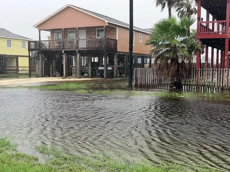
This developing system is projected to bring substantial rainfall to the coasts of Mexico, Texas, and Louisiana in the coming days. Rainfall from this system could start as early as Tuesday, but Wednesday and Thursday are expected to see the heaviest precipitation.
The storm may lead to total rainfall amounts ranging from five to ten inches across regions including the coast of Texas, Louisiana, Mississippi, Alabama, and parts of the Florida panhandle. This heavy rain raises the risk of flooding in impacted areas, including cities such as Houston, Brownsville, Beaumont, Lake Charles, New Orleans, Mobile, and Pensacola. Residents should prepare for not just heavy rain, but also stronger wind gusts accompanying the downpours.
In addition to the Gulf concerns, another system in the Atlantic currently has a 40% chance of development within the week. A third weather complex has a lower likelihood of formation, at just 20% over the next seven days. Meanwhile, the West Coast is grappling with high heat and dry conditions, creating a precarious environment.
More than 15 million people in Southern California are under an excessive heat warning that extends through Monday, with temperatures predicted to soar between 100 and 110 degrees Fahrenheit. Certain heat alerts may ease by Saturday in the Pacific Northwest and central California, but concerns remain.
Fire weather conditions are alarming, with Red Flag Warnings in effect due to the combination of high temperatures and dry air. Such conditions facilitate the ignition and rapid spread of wildfires, which has been evident in recent events—California has seen six new significant fires ignite since Thursday.
One of the largest fires, the Line Fire, erupted on Thursday and has already burned approximately 4,000 acres, remaining at 0% containment. Authorities have issued evacuation orders in San Bernardino County in response to the dangerous situation.
Despite the ongoing heat, there is a hint of relief on the horizon. The middle of the month could see a break from the intense heat affecting much of the West, as above-average temperatures are expected to shift toward the Midwest and East.
Residents in susceptible regions are urged to stay informed and take necessary precautions as these weather events unfold, which could cause significant impacts across affected areas.
Source: ABC News