Physical Address
304 North Cardinal St.
Dorchester Center, MA 02124
Physical Address
304 North Cardinal St.
Dorchester Center, MA 02124

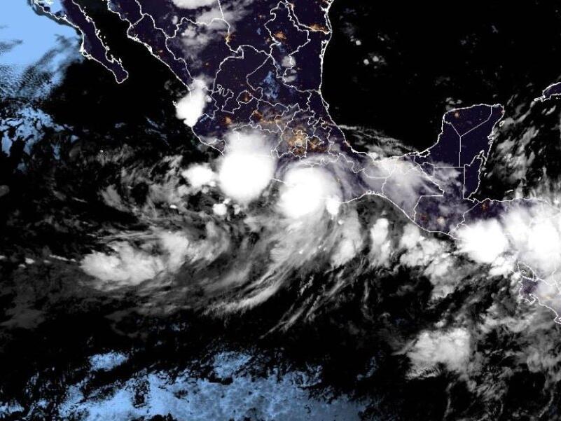
On the evening of September 24, Major Hurricane John made landfall as a Category 3 storm along Mexico’s Pacific coast. Forecasters have issued severe warnings of potential flash flooding and other life-threatening conditions in the region.
The storm hit around 9:15 p.m. CST, coming ashore just southwest of Marquelia in the state of Guerrero, according to the National Hurricane Center. Hurricane John brought with it maximum sustained winds of 120 mph, classifying it firmly as a Category 3 hurricane on the Saffir-Simpson scale.
This weather event is being characterized by its slow movement, as the hurricane is currently traveling north at approximately 8 mph. Shortly before landfall, forecasters alerted residents that Mexico’s southwestern coast was already experiencing damaging hurricane-force winds, along with storm surges and flash flooding.
A hurricane warning was in effect for regions extending from east of Acapulco to Bahías de Huatulco. Furthermore, a tropical storm warning was issued for the areas east of Bahías de Huatulco to Salina Cruz.
As John continues to progress inland across southern Mexico on Tuesday, meteorologists predict that the storm will weaken significantly. Despite this rapid deterioration, heavy rainfall is expected to continue impacting the region.
According to a statement from the National Hurricane Center, “Slow-moving Hurricane John will bring very heavy rainfall to coastal portions of southwest Mexico through the upcoming week.” They warn that this significant rainfall may lead to catastrophic flash flooding and mudslides in the Mexican states of Chiapas, Oaxaca, and southeast Guerrero, particularly in coastal areas.
The rainfall forecast is alarming, with predictions suggesting that coastal Chiapas could receive between 6 to 12 inches of rain, and in some isolated areas, totals could reach as high as 15 inches. In addition, areas along the Oaxaca coast and southeast Guerrero may expect between 10 and 20 inches, with some locations potentially seeing totals soar to 30 inches.
In a proactive measure, President Andrés Manuel López Obrador took to social media two hours prior to landfall to warn citizens. He urged them to “seek higher ground, protect yourselves, and do not forget that life is the most important thing; material things can be replaced.”
The impending conditions resulting from Hurricane John are prompting safety measures and preparations among residents. Local authorities are mobilizing resources to ensure that communities are as prepared as possible for the storm’s impact.
As the situation develops, it is crucial for those in the affected areas to stay informed through official channels and heed the advice of local officials. The aftermath of the storm could lead to severe infrastructure challenges, particularly in areas prone to flooding and landslides.
Hurricane preparedness plans are essential at this moment, and residents are encouraged to secure their belongings and take necessary precautions to safeguard their lives. The government and emergency services are expected to remain vigilant and ready to respond to any emergencies arising from this dangerous storm.
As the region braces for the worst, the impacts of Hurricane John will be monitored closely, with updates likely to follow as conditions evolve throughout the week. Addressing the needs of those affected efficiently and effectively will be a top priority in the coming days.
Source: UPI