Physical Address
304 North Cardinal St.
Dorchester Center, MA 02124
Physical Address
304 North Cardinal St.
Dorchester Center, MA 02124

A potential tropical system has hit parts of North Carolina with unprecedented rainfall, causing severe flooding and stranding numerous drivers. Flash flood watches remain in effect across southeastern North Carolina as the storm moves northward. Meanwhile, severe thunderstorms are forecasted to bring additional heavy rains to the High Plains and Rockies.
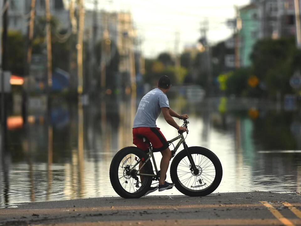
On Tuesday morning, areas in southeastern Virginia and North Carolina were still under flood watches after the storm unleashed rainfall that occurs only once in a thousand years. In Carolina Beach, a coastal locale approximately 10 miles south of Wilmington, over 18 inches of rain fell within just 12 hours, according to the National Weather Service.
Wind gusts reaching up to 77 mph impacted the coastline, as reported by Weather.com. A flash flood warning was issued until 6:45 a.m. Tuesday for parts of Carteret and Craven counties, where the threat of “life-threatening flash flooding” was prevalent.
This storm system, while disorganized and not formally categorized as a tropical storm, has had significant impacts consistent with those of a tropical storm, explained AccuWeather’s lead hurricane expert, Alex DaSilva.
In response to the flooding, both Carolina Beach and Oak Island, located roughly 30 miles south of Wilmington, declared states of emergency. Floodwaters resulted in numerous road closures, damaged structures, and left people stranded on highways.
The weather service issued warnings through social media platform X, reporting that some roads in Carolina Beach were inundated with floodwater reaching depths of at least three feet; images showed a van submerged in water.
Rescue operations were underway in the area, with the town’s fire department successfully rescuing 57 individuals and 12 animals on Monday, as stated by Carolina Beach Mayor Lynn Barbee. Police also conducted rescues, utilizing a 5-ton truck to assist 12 stranded individuals within the same timeframe.
In light of the flooding, officials facilitated the return of children from Carolina Beach schools using high-water vehicles due to the inability of buses to navigate flooded routes, as reported by the New Hanover County Sheriff’s Office.
The North Carolina Transportation Department indicated that certain roads in the southeastern part of the state would remain closed “for the foreseeable future.” Motorists have been urged to avoid traveling while emergency repairs take place, especially concerning multiple damaged bridges.
Highway 17 near Wilmington experienced extensive delays, stranding some individuals for hours. Others sought refuge from the rising waters at an Exxon gas station nearby, according to reports from the Wilmington Star News, part of the USA TODAY Network.
In Brunswick County, just west of Wilmington, deputies and public safety personnel worked diligently to deliver food, water, and necessary supplies to drivers caught in the floods, as mentioned in an official news release.
Public schools, offices, parks, and libraries across the county will remain closed on Tuesday, with an overnight curfew imposed on unincorporated areas until 6 a.m. on Tuesday.
Southport, a city along the eastern coastline with around 4,000 residents, saw approximately 23 inches of rain over the last 48 hours. During a live broadcast, AccuWeather meteorologist Aaron Jayjack reported the collapse of a bridge in the background, leading to a vehicle and its driver tumbling into the water. Fortunately, bystanders rescued the driver, who sustained only minor injuries.
In addition to the situation in North Carolina, the storm system is affecting parts of Florida, where flood warnings are in effect for the northeastern coastline until early Wednesday morning. Beaches along this region are experiencing rough surf and dangerous rip currents, exceeding six feet.
Forecasters anticipate that the storm will continue its northerly movement across North Carolina toward the Mid-Atlantic, resulting in thunderstorms and heavy rainfall until its dissipation on Wednesday. Meanwhile, a strong low-pressure storm system is expected to form in the West on Tuesday, traveling through the central Plains and into the Rockies, with risks of severe thunderstorms, gusty winds, and showers.
The northern High Plains, in particular, face the most significant risk of thunderstorms, which may even include isolated instances of large hail. Northeastern Colorado, northwestern Kansas, and western Nebraska may experience wind gusts exceeding 70 mph.
Source: USA TODAY


