Physical Address
304 North Cardinal St.
Dorchester Center, MA 02124
Physical Address
304 North Cardinal St.
Dorchester Center, MA 02124

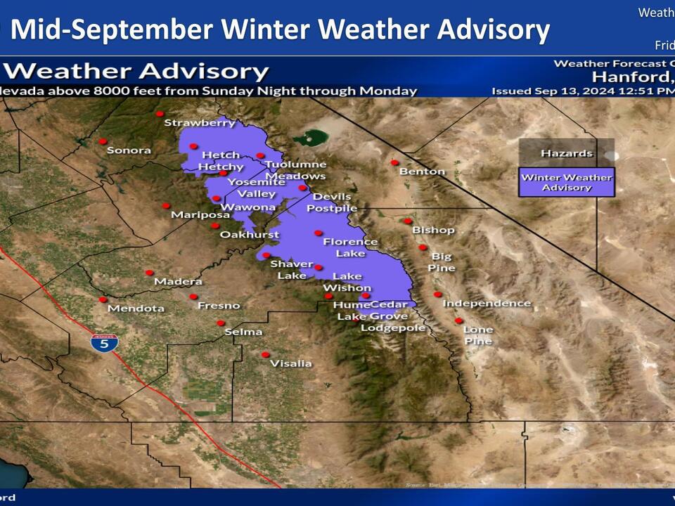
This week, California has issued its earliest snow advisory in two decades for residents in the Sierra Nevada, as reported by the National Weather Service. The advisory indicates that between Sunday and Monday, regions above 8,000 feet in the Sierra Nevada are likely to receive snowfall.
A cold front, characterized as a trough of low atmospheric pressure, is expected to bring a 35% to 65% chance of at least 2 inches of snow in those elevated areas. JP Kalb, a forecaster with the National Weather Service, highlighted the intensity of this weather system, stating, “We have a very cold draft moving into the area this afternoon and evening, and it will continue into Monday.”
In addition to snow, rain is anticipated in the San Joaquin Valley, which could lead to slick roads and difficult driving conditions in various parts of the state.
The winter weather advisory will be active from 11 p.m. local time on Sunday through 5 p.m. on Monday, emphasizing the possibility of hazardous travel conditions.
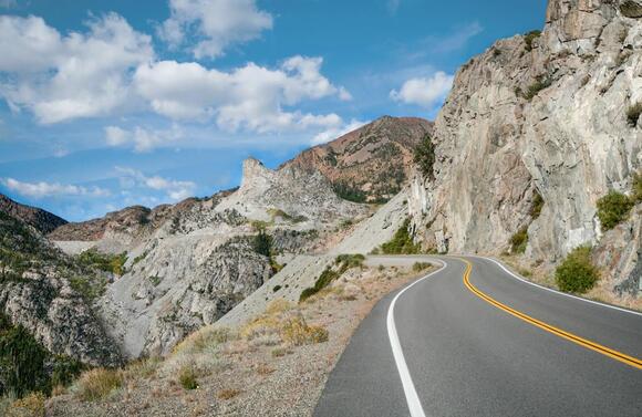
In particular, California’s State Road 120, which traverses the Tioga Pass near Yosemite National Park, is projected to receive more snow than other locations. This area is situated at an elevation of 9,943 feet and typically experiences winter closures due to heavy snowfall.
The forecast suggests there is about a 40% chance that Tioga Pass could see 3 inches of snow or more. Travelers heading through the Sierra Nevada should be prepared for possible road closures and should have alternative plans in place.
Yosemite National Park officials will monitor conditions closely and decide whether to close State Road 120 if weather conditions deteriorate, as indicated by David Spector, a meteorologist with the weather service.
Looking ahead, there is another opportunity for snow later in the week. A second trough is expected to move into the area from Wednesday to Thursday, with a 40% chance that Tioga Pass could again receive 3 inches or more of snow.
Despite the anticipated precipitation, the wildfires currently affecting Southern California will not be mitigated by this weather system. Kalb pointed out, “Most of the wildfires are well south of where we have the advisory.” Additionally, the weather service predicts that the overall precipitation in the area will be 33% to 40% below average.
Although this early winter weather advisory brings some snowfall prospects, the ongoing drought affecting regions of both Northern and Southern California may continue to grow worse into September. This situation heightens the need for moisture in these drought-stricken areas.
This unusual early snow event serves as a reminder of California’s extensive and sometimes unpredictable seasonal weather patterns. The combination of snow at high elevations and rain at lower levels illustrates the complexity and variability characteristic of the state’s climate.
Residents and visitors in affected zones are urged to stay informed about weather conditions and heed any advisories or warnings issued by the National Weather Service. Proper preparation can enhance safety during this early onset of winter weather.
Source: USA Today